
CONE 12 What’s New And What Has Changed
The release of CONE 12 introduces several new exciting and useful features, along with a range of enhancements, fixes, new and improved documentation.
There are also important changes to support services, licence authorisation and CAD compatibility.
CONE 11 is retired, and future ongoing support will only available for end users with a current support contract.
Support for CONE10 is no longer available.
CONE 12 Support Services
Support services as outlined in the CONE 12 EULA are included for all new licences and upgrades for the first 3 months from delivery date.
Our support services include any fixes and current CONE 12 version releases (but not new versions) that we may issue from time to time.
CONE 12 support services can be extended for a further 12 months and thereafter yearly upon payment of a fee currently £180 + VAT
NEW Online Authorisation Method
For CONE 12, we have transitioned to a fully online authorisation method. The first time you launch a tool in CONE 12, registration and activation will process automatically behind the scenes (provided you have an active internet connection).
- Simplified Asset Management: Significantly streamlines initial activation, deactivation, and reactivation across your machines.
- Self-Service Updates: Removes the requirement to manually send activation keys or removal requests to our support team.
- Licence Manager Interface: Access the dedicated CONE12INFO tool to quickly manage and view your active licences.
- Remote Deactivations: If a machine is damaged, lost, or stolen, our team can now remotely deactivate the licence for you.
CAD Compatability
CONE 12 for BricsCAD requires BricsCAD V20 or higher. Please get in touch if you require a BricsCAD upgrade.
CONE 12 for AutoCAD compatibility remains unchanged. Please note AutoCAD LT is not supported.
New Features
Background Mapping Enhancements
(Note: These specific mapping background and direction features apply to Great Britain only).
- OS Open Map Local and District Tiles: The legacy OS Raster Image Loader tool has been renamed and upgraded to better reflect its targeted functionality.
- Direct Cloud Access: Ordnance Survey 5K and 10K Open Plan tiles can now be imported directly from our free, cloud-based online resource.
- OS Data Hub Integration: Generate and import custom rectangular map zones from the OS Data Hub, directly supporting:
- Ordnance Survey Open Plan Raster images.
- Ordnance Survey Premium MasterMap Raster images (requires API key).
- Ordnance Survey Premium Vector MasterMap (requires API key).
- Ordnance Survey Open Plan Road Centre Lines.
- Google Maps & Satellite Data: Import custom areas filled with Google Satellite and Road Map Raster Imagery directly into your CAD environment (requires API key).
- Google Earth Pro Compatibility: Easily import high-resolution Google Earth Satellite imagery saved directly from the free Google Earth Desktop Pro application.
Diversion Route Planning
- Route Directions Tool: Easily construct standard “A to B via C” route diversion paths directly onto your active CAD maps.
- Road Closures & Diversions: Designate a specific “Blocked Area” to automatically plan alternate vehicle paths around site works.
- Automated Data Tables: Instantly generate detailed Route Direction Instruction tables paired with corresponding lists of diverted traffic signs.
- Dynamic Sign Placement: Utilise multiple automated insertion techniques to populate diverted traffic signage along your active route paths.
Map Querying Tools
- Google Street View Launch: Pick any coordinate point directly on your CAD map to instantly open a web browser to that exact Google Street View location.
- Unified Map Query Tool: Click any point on your scheme to pull localized roadway details, postcodes, What3Words addresses, exact coordinates, and elevations.
- External Mapping Access: Bounce drawing coordinates to external browser windows for Google Maps, Google Earth, OpenStreetMap and others.
- Elevation Profiles: Instantly plot vertical elevation profiles directly from existing drawing Polylines.
- Unique OS Grid Offset Tool: Shift your design map away from its original OS default spatial coordinate location to a more convenient workspace area in your drawing, while ensuring all tool queries still return the correct, original OS spatial coordinates.
CONE 12 Core Programme Tools & Improvements
New Core Tools
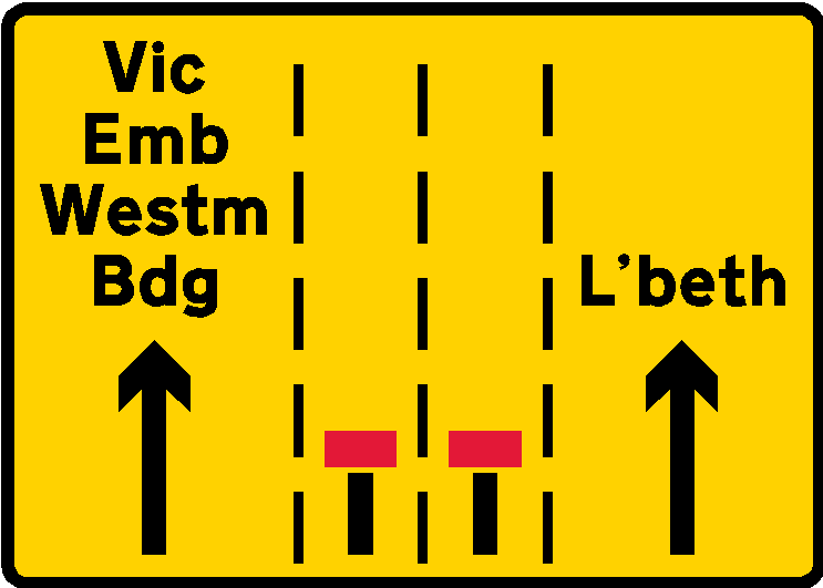
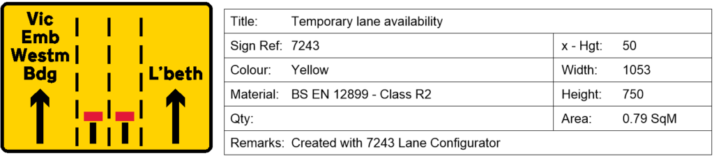
- Custom 7243 Sign Lane Configurator: Similar to the 7244 Destination tool, but specifically tailored for all-purpose urban road networks and city-centre traffic management schemes. It is significantly faster, simpler, and more flexible to manipulate.
- Align Map View Tool: Added to simplify a view rotation (alternative to rotating the view around the UCS)
- CONE / CAD Configuration Tool: CAD settings that users say are the most important have been collected into a single dialog. A quick set to recommended settings is included along with the ability to turn ALL CONE toolbars ON or OFF.
CONE 12 Core Programme Improvements, Enhancements And Fixes
- Query Sign: The option to create a configurable sign information table has been added.
- Signs and Sign Leaders: All dialog based tools that insert signs, leaders and sign symbols allow the signs and sign symbols to be independently scaled.
- Sign Arrays: Several fixes have been applied to the Sign Array Tool, The sign symbol offset value can now be negative.
- Frequent Signs inserted from the Ribbon or Toolbar can now be configured to insert Welsh bilingual where applicable. Common Welsh translation lookup datasets have been built natively into various custom sign design paths via PDF, HTML, and CSV formats.
- Frequent Signs: Fixed issue where the sign configuration was without leaders.
- 7202.1 Signs: Additional 6th lane added to 7202.1 Wicket Signs creation tool.
- 7244 Destinations: Add zone left now works correctly, changed zone selection method from pick to radio buttons.
- Work Space hatch: Dialog settings now update correctly.
- UCS: The majority of cone tools will now work in a UCS (a view that is rotated around the Z axis but is still parallel to the WCS) without the user having to switching back to the WCS first, the switching is taken care of by the program. The notable exception are the Chapter 7 sign design tools.
- ViewUp: A new ViewUp option has been added to the dialog of all signs tools. ViewUp means the sign is rotated upright with respect to the current view. If you are working normally in Plan view WCS then the ViewUP and Zero sign rotations are the same.
- Traffic Light Phase Tables: Headers and footers now update.
Chapter 7 Sign Design Tools
- Dedicated Lane, Shared Dedicated Lanes and TigerTail tools have been modified to correctly check for valid Chapter 7 Sign Design objects when selecting objects to include.
- The Green and White background options in the Tiger Tails tool now render correctly.
- Added a workaround to the Finalise Sign Tool when selecting the create Working Drawing option. Due to a bug in BricsCAD some versions of Bricscad would create a very, very large rectangle.
- Fixed issue with stacked signs in sign scheduler not picking up similar but opposite handed signs.
- Signs Database: Additional Welsh/English signs added to Signs database.
New 7245 (Narrow Lane) Signs Additional 7245 (Lane Alignment) Signs.
Inclusion of National Highways logo where applicable - 7202,7244 and 7245 Sign Dialogs: Some improvements have been made to facilitate users who have high resolution displays and scaling not set to reccomended.
- New Online V12 Help Files plus YouTube and PDF tutorials (as we create them).
- CONE 12 will inherit any existing current User settings and User Files stored in
Users/AppData/Roaming/CONE11UK. - Most dialogs (but not all) will inherit their settings from CONE 11.
- Various other fixes and enhancements.